
The Blueprint Beneath: How Detailed Mapping Powers Modern Infrastructure
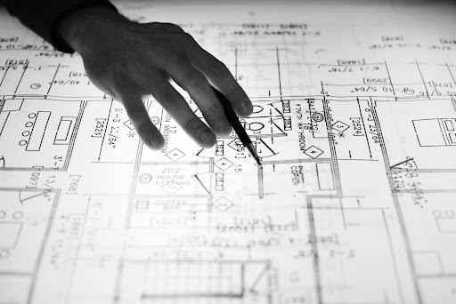
Modern infrastructure is built on accuracy, planning, and a deep understanding of the land. From urban developments to large-scale engineering projects, every successful construction begins with precise data and careful analysis. Mapping and surveying play a crucial role in ensuring that projects are executed efficiently, minimizing risks, and maximizing long-term value.
At the core of this process lies the importance of a topo survey, which provides detailed insights into land features, elevations, and natural elements. By capturing accurate data, these surveys help engineers, architects, and planners make informed decisions, ensuring that infrastructure projects are both sustainable and structurally sound.
Driving Precision and Planning Through Topo Survey in Modern Infrastructure Projects
Accurate mapping is essential for successful infrastructure development. A topo survey enables professionals to visualize land characteristics and plan projects with precision and confidence.
1. Understanding Land Elevation and Terrain
A detailed survey provides crucial information about elevation changes and terrain features. This data helps engineers design structures that align with the natural landscape, reducing the need for extensive modifications. By understanding slopes, contours, and gradients, professionals can ensure better drainage systems and stable construction foundations.
2. Enhancing Project Planning Accuracy
Accurate mapping allows planners to visualize the entire project before execution. This foresight helps identify potential challenges and develop effective solutions. By incorporating survey data into planning processes, projects can be completed more efficiently, with fewer delays and cost overruns.
3. Supporting Sustainable Development
Sustainability is a key consideration in modern infrastructure. Surveys help identify natural features such as water bodies, vegetation, and soil conditions, enabling environmentally responsible planning. This ensures that development projects minimize their impact on the surrounding ecosystem.
4. Improving Construction Efficiency
With precise data, construction teams can execute projects with greater accuracy. This reduces errors, minimizes rework, and enhances overall efficiency. Detailed mapping ensures that every phase of construction aligns with the original design and specifications.
5. Reducing Risks and Uncertainties
Unexpected challenges can lead to costly delays. Surveys help identify potential risks early, allowing teams to address them proactively. This risk management approach ensures smoother project execution and improved outcomes.
6. Facilitating Better Communication
Survey data provides a clear and visual representation of the project site. This helps stakeholders understand project requirements and collaborate effectively, ensuring alignment throughout the development process.
Transforming Infrastructure Development with Advanced Mapping and Survey Technologies
Technological advancements have revolutionized the field of surveying. Modern tools and techniques have significantly improved accuracy, efficiency, and data analysis in infrastructure projects.
1. Integration of Digital Mapping Tools
Digital tools allow for precise data collection and analysis. These technologies provide detailed visualizations that enhance decision-making and project planning.
2. Use of Drones and Aerial Surveys
Drones enable quick and efficient data collection over large areas. Aerial surveys provide high-resolution images and accurate measurements, improving overall project efficiency.
3. Real-Time Data Processing
Modern systems allow for real-time data processing, enabling faster decision-making. This reduces delays and ensures that projects stay on schedule.
4. Enhanced Accuracy with GPS Technology
Advanced GPS systems provide highly accurate location data. This ensures precise measurements and improves the reliability of survey results.
5. Improved Data Visualization
Modern software tools create detailed 3D models of project sites. These visualizations help stakeholders better understand project requirements and outcomes.
6. Automation in Surveying Processes
Automation reduces manual effort and increases efficiency. This ensures faster data collection and more consistent results across projects.
The Role of Surveying in Sustainable Urban and Infrastructure Growth
Sustainable development requires careful planning and resource management. Surveying plays a critical role in ensuring that infrastructure projects align with environmental and social goals.
1. Supporting Smart City Development
Accurate mapping is essential for designing smart cities. Surveys provide the data needed to plan efficient transportation systems, utilities, and urban layouts.
2. Protecting Natural Resources
Survey data helps identify and preserve natural features. This ensures that development projects minimize environmental impact and promote sustainability.
3. Optimizing Land Use
Efficient land use is crucial for sustainable growth. Surveys help planners allocate resources effectively, ensuring optimal utilization of available space.
4. Enhancing Infrastructure Resilience
Understanding land conditions helps design structures that can withstand environmental challenges. This improves the durability and longevity of infrastructure projects.
5. Supporting Regulatory Compliance
Surveys ensure that projects comply with local regulations and standards. This reduces legal risks and ensures smooth project execution.
6. Enabling Long-Term Planning
Accurate data supports long-term planning and development strategies. This ensures that infrastructure projects remain relevant and effective over time.
Choosing the Right Surveying Approach for Reliable and Accurate Results
Selecting the appropriate surveying method is essential for achieving accurate results. A well-planned approach ensures that projects are executed efficiently and effectively.
1. Understanding Project Requirements
Different projects require different surveying methods. Identifying specific needs ensures that the right approach is used for accurate data collection.
2. Importance of Skilled Professionals
Experienced surveyors play a key role in ensuring accuracy and reliability. Their expertise helps deliver high-quality results that meet project requirements.
3. Utilizing Advanced Equipment
Modern equipment enhances precision and efficiency. Using the latest tools ensures accurate data collection and analysis.
4. Ensuring Data Accuracy and Validation
Data validation is crucial for reliable results. Proper verification processes ensure that survey data is accurate and dependable.
5. Balancing Cost and Efficiency
Choosing the right approach helps optimize costs without compromising quality. Efficient planning ensures maximum value for investment.
6. Adapting to Changing Project Needs
Flexibility is essential in surveying. Adapting methods to changing requirements ensures successful project outcomes.
Final Thoughts
Accurate mapping and detailed surveying are essential for successful infrastructure development. From planning and design to execution and sustainability, these processes ensure that projects are efficient, reliable, and future-ready. By leveraging advanced technologies and expert knowledge, organizations can achieve better outcomes and long-term value.
For those seeking reliable expertise, choosing among the topographic survey companies in uae is a critical decision. Lyca Survey stands out as a trusted partner, offering precise data, advanced solutions, and professional expertise. With a commitment to quality and innovation, they help clients achieve accurate results and successful project execution. By partnering with them, businesses can build strong foundations and drive infrastructure development with confidence and precision.